


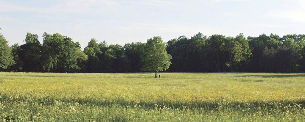
Separate or Nizhny is the most “popular” park in the city of Pushkin. It serves as a favorite and accessible recreational spot for city residents, a dog-walking area, and a city-wide kebab shop.
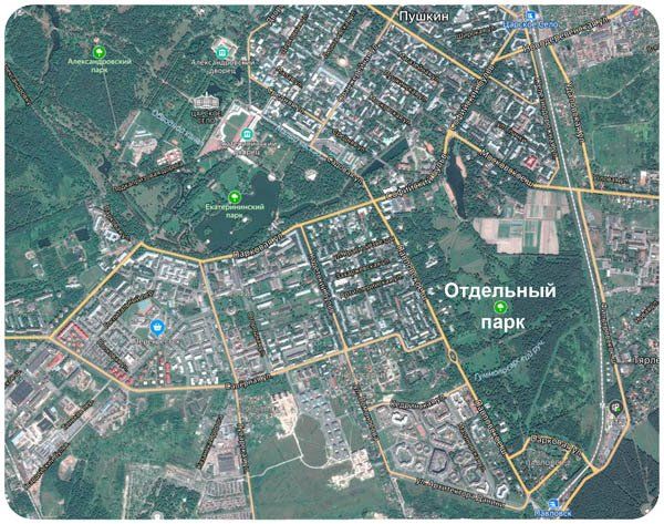
SEPARATE (LOWER) PARK IN PUSHKIN. BASIC INFORMATION.

Not far from Kolonistsky Pond,
BRIEF HISTORY OF THE CREATION OF A SEPARATE (LOWER) PARK

A separate park is located between the Catherine and Pavlovsky parks, without bordering them. The park is limited in width by the Vitebsk direction railway and Pavlovsk highway, and in length by the Moskovsky highway in Pushkin and Parkovaya street in Pavlovsk.

Unlike the three other parks of Tsarskoe Selo, which are merged territorially, the Separate Park occupies a separate area from them. In the past, it was also called Sofia - after the name of the boulevard passing nearby, Kolonistsky - after the nearby Friedenthal Colony, and Nizhny - after its geographical location and relief features relative to the Catherine Palace and Park.

This place was previously known as the Polozor wasteland. The Traveling Belozersky Palace is a small stone building, built by architect A.I. Kvasov in 1744, and five years later it was rebuilt and expanded by B.-F. Rastrelli and S.I. Chevakinsky. A village called Belozerka, derived from the name of the wasteland, was founded near the palace for dairy farming. Three dozen peasant families from the Bolshoye Kuzmino settlement were resettled there in 1745, but soon only the family of the peasant woman Tatyana Ivanova remained here, after whom Belozerka received its second name - Tatyanovka, a toponym that has survived to this day.

The School’s project was not fully implemented, but some of its basic ideas were used in the construction of the Farm in Alexander Park. After the school closed in 1804, the stone Belozersky house with a garden was granted to garden master Joseph Bush for his long-term service in gardening.

The canal begins outside the park, from the Factory Dam of the 5th Lower Pond, where in those years there was a banknote paper factory, later a wallpaper and tapestry factory. Below, two ponds, rectangular in plan, were dug to store water.
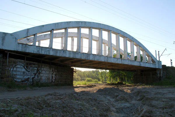
During the construction of the Moscow-Vindavo-Rybinsk railway (now the Vitebsk railway) in the 1890-1900s. A railway bridge was built over the water pipeline channel, the openwork design of which organically fits into the perspective of Oak Alley.

